pacman::p_load(sf, tidyverse)Hands-on Exercise 1
Getting Started
Installing and launching R packages
The code chunk below uses p_load() of pacman to check if tidyverse and sf are installed in the computer. If they are, they will be loaded by R.
Importing data
Master Plan 2014 Subzone Boundary (Shapefile)
mpsz = st_read(dsn = "data/geospatial/Master_Plan_2014_Subzone", layer = "MP14_SUBZONE_WEB_PL")Reading layer `MP14_SUBZONE_WEB_PL' from data source
`/home/tropicbliss/GitHub/quarto-project/Hands-on_Ex/Hands-on_Ex01/data/geospatial/Master_Plan_2014_Subzone'
using driver `ESRI Shapefile'
Simple feature collection with 323 features and 15 fields
Geometry type: MULTIPOLYGON
Dimension: XY
Bounding box: xmin: 2667.538 ymin: 15748.72 xmax: 56396.44 ymax: 50256.33
Projected CRS: SVY21Cycling Path 2014 (Shapefile)
cyclingpath = st_read("data/geospatial/Cycling_Path_2014", layer = "CyclingPathGazette")Reading layer `CyclingPathGazette' from data source
`/home/tropicbliss/GitHub/quarto-project/Hands-on_Ex/Hands-on_Ex01/data/geospatial/Cycling_Path_2014'
using driver `ESRI Shapefile'
Simple feature collection with 3138 features and 2 fields
Geometry type: MULTILINESTRING
Dimension: XY
Bounding box: xmin: 11854.32 ymin: 28347.98 xmax: 42644.17 ymax: 48948.15
Projected CRS: SVY21Pre-school Locations (KML)
preschool = st_read("data/geospatial/PreSchool_Location/PreSchoolsLocation.kml")Reading layer `PRESCHOOLS_LOCATION' from data source
`/home/tropicbliss/GitHub/quarto-project/Hands-on_Ex/Hands-on_Ex01/data/geospatial/PreSchool_Location/PreSchoolsLocation.kml'
using driver `LIBKML'
Simple feature collection with 2290 features and 16 fields
Geometry type: POINT
Dimension: XYZ
Bounding box: xmin: 103.6878 ymin: 1.247759 xmax: 103.9897 ymax: 1.462134
z_range: zmin: 0 zmax: 0
Geodetic CRS: WGS 84Analysing the data
Extract geometry of a simple features object
mpsz is a data frame-like like object where one of the columns contains geometric data. st_geometry returns a list of geometries.
st_geometry(mpsz)Geometry set for 323 features
Geometry type: MULTIPOLYGON
Dimension: XY
Bounding box: xmin: 2667.538 ymin: 15748.72 xmax: 56396.44 ymax: 50256.33
Projected CRS: SVY21
First 5 geometries:MULTIPOLYGON (((31495.56 30140.01, 31980.96 296...MULTIPOLYGON (((29092.28 30021.89, 29119.64 300...MULTIPOLYGON (((29932.33 29879.12, 29947.32 298...MULTIPOLYGON (((27131.28 30059.73, 27088.33 297...MULTIPOLYGON (((26451.03 30396.46, 26440.47 303...Extract attribute information of a simple features object
glimpse(mpsz)Rows: 323
Columns: 16
$ OBJECTID <int> 1, 2, 3, 4, 5, 6, 7, 8, 9, 10, 11, 12, 13, 14, 15, 16, 17, …
$ SUBZONE_NO <int> 1, 1, 3, 8, 3, 7, 9, 2, 13, 7, 12, 6, 1, 5, 1, 1, 3, 2, 2, …
$ SUBZONE_N <chr> "MARINA SOUTH", "PEARL'S HILL", "BOAT QUAY", "HENDERSON HIL…
$ SUBZONE_C <chr> "MSSZ01", "OTSZ01", "SRSZ03", "BMSZ08", "BMSZ03", "BMSZ07",…
$ CA_IND <chr> "Y", "Y", "Y", "N", "N", "N", "N", "Y", "N", "N", "N", "N",…
$ PLN_AREA_N <chr> "MARINA SOUTH", "OUTRAM", "SINGAPORE RIVER", "BUKIT MERAH",…
$ PLN_AREA_C <chr> "MS", "OT", "SR", "BM", "BM", "BM", "BM", "SR", "QT", "QT",…
$ REGION_N <chr> "CENTRAL REGION", "CENTRAL REGION", "CENTRAL REGION", "CENT…
$ REGION_C <chr> "CR", "CR", "CR", "CR", "CR", "CR", "CR", "CR", "CR", "CR",…
$ INC_CRC <chr> "5ED7EB253F99252E", "8C7149B9EB32EEFC", "C35FEFF02B13E0E5",…
$ FMEL_UPD_D <date> 2014-12-05, 2014-12-05, 2014-12-05, 2014-12-05, 2014-12-05…
$ X_ADDR <dbl> 31595.84, 28679.06, 29654.96, 26782.83, 26201.96, 25358.82,…
$ Y_ADDR <dbl> 29220.19, 29782.05, 29974.66, 29933.77, 30005.70, 29991.38,…
$ SHAPE_Leng <dbl> 5267.381, 3506.107, 1740.926, 3313.625, 2825.594, 4428.913,…
$ SHAPE_Area <dbl> 1630379.27, 559816.25, 160807.50, 595428.89, 387429.44, 103…
$ geometry <MULTIPOLYGON [m]> MULTIPOLYGON (((31495.56 30..., MULTIPOLYGON (…Return the first few rows of a data frame
head(mpsz, n=5)Simple feature collection with 5 features and 15 fields
Geometry type: MULTIPOLYGON
Dimension: XY
Bounding box: xmin: 25867.68 ymin: 28369.47 xmax: 32362.39 ymax: 30435.54
Projected CRS: SVY21
OBJECTID SUBZONE_NO SUBZONE_N SUBZONE_C CA_IND PLN_AREA_N
1 1 1 MARINA SOUTH MSSZ01 Y MARINA SOUTH
2 2 1 PEARL'S HILL OTSZ01 Y OUTRAM
3 3 3 BOAT QUAY SRSZ03 Y SINGAPORE RIVER
4 4 8 HENDERSON HILL BMSZ08 N BUKIT MERAH
5 5 3 REDHILL BMSZ03 N BUKIT MERAH
PLN_AREA_C REGION_N REGION_C INC_CRC FMEL_UPD_D X_ADDR
1 MS CENTRAL REGION CR 5ED7EB253F99252E 2014-12-05 31595.84
2 OT CENTRAL REGION CR 8C7149B9EB32EEFC 2014-12-05 28679.06
3 SR CENTRAL REGION CR C35FEFF02B13E0E5 2014-12-05 29654.96
4 BM CENTRAL REGION CR 3775D82C5DDBEFBD 2014-12-05 26782.83
5 BM CENTRAL REGION CR 85D9ABEF0A40678F 2014-12-05 26201.96
Y_ADDR SHAPE_Leng SHAPE_Area geometry
1 29220.19 5267.381 1630379.3 MULTIPOLYGON (((31495.56 30...
2 29782.05 3506.107 559816.2 MULTIPOLYGON (((29092.28 30...
3 29974.66 1740.926 160807.5 MULTIPOLYGON (((29932.33 29...
4 29933.77 3313.625 595428.9 MULTIPOLYGON (((27131.28 30...
5 30005.70 2825.594 387429.4 MULTIPOLYGON (((26451.03 30...Getting the coordinate system of the feature object
st_crs(mpsz)Coordinate Reference System:
User input: SVY21
wkt:
PROJCRS["SVY21",
BASEGEOGCRS["SVY21[WGS84]",
DATUM["World Geodetic System 1984",
ELLIPSOID["WGS 84",6378137,298.257223563,
LENGTHUNIT["metre",1]],
ID["EPSG",6326]],
PRIMEM["Greenwich",0,
ANGLEUNIT["Degree",0.0174532925199433]]],
CONVERSION["unnamed",
METHOD["Transverse Mercator",
ID["EPSG",9807]],
PARAMETER["Latitude of natural origin",1.36666666666667,
ANGLEUNIT["Degree",0.0174532925199433],
ID["EPSG",8801]],
PARAMETER["Longitude of natural origin",103.833333333333,
ANGLEUNIT["Degree",0.0174532925199433],
ID["EPSG",8802]],
PARAMETER["Scale factor at natural origin",1,
SCALEUNIT["unity",1],
ID["EPSG",8805]],
PARAMETER["False easting",28001.642,
LENGTHUNIT["metre",1],
ID["EPSG",8806]],
PARAMETER["False northing",38744.572,
LENGTHUNIT["metre",1],
ID["EPSG",8807]]],
CS[Cartesian,2],
AXIS["(E)",east,
ORDER[1],
LENGTHUNIT["metre",1,
ID["EPSG",9001]]],
AXIS["(N)",north,
ORDER[2],
LENGTHUNIT["metre",1,
ID["EPSG",9001]]]]Adjusting the data
Adjusting the EPSG code
mpsz3414 <- st_set_crs(mpsz, 3414)Warning: st_crs<- : replacing crs does not reproject data; use st_transform for
thatst_crs(mpsz3414)Coordinate Reference System:
User input: EPSG:3414
wkt:
PROJCRS["SVY21 / Singapore TM",
BASEGEOGCRS["SVY21",
DATUM["SVY21",
ELLIPSOID["WGS 84",6378137,298.257223563,
LENGTHUNIT["metre",1]]],
PRIMEM["Greenwich",0,
ANGLEUNIT["degree",0.0174532925199433]],
ID["EPSG",4757]],
CONVERSION["Singapore Transverse Mercator",
METHOD["Transverse Mercator",
ID["EPSG",9807]],
PARAMETER["Latitude of natural origin",1.36666666666667,
ANGLEUNIT["degree",0.0174532925199433],
ID["EPSG",8801]],
PARAMETER["Longitude of natural origin",103.833333333333,
ANGLEUNIT["degree",0.0174532925199433],
ID["EPSG",8802]],
PARAMETER["Scale factor at natural origin",1,
SCALEUNIT["unity",1],
ID["EPSG",8805]],
PARAMETER["False easting",28001.642,
LENGTHUNIT["metre",1],
ID["EPSG",8806]],
PARAMETER["False northing",38744.572,
LENGTHUNIT["metre",1],
ID["EPSG",8807]]],
CS[Cartesian,2],
AXIS["northing (N)",north,
ORDER[1],
LENGTHUNIT["metre",1]],
AXIS["easting (E)",east,
ORDER[2],
LENGTHUNIT["metre",1]],
USAGE[
SCOPE["Cadastre, engineering survey, topographic mapping."],
AREA["Singapore - onshore and offshore."],
BBOX[1.13,103.59,1.47,104.07]],
ID["EPSG",3414]]Transforming the coordinate system
preschool3414 <- st_transform(preschool, crs = 3414)st_crs(preschool3414)Coordinate Reference System:
User input: EPSG:3414
wkt:
PROJCRS["SVY21 / Singapore TM",
BASEGEOGCRS["SVY21",
DATUM["SVY21",
ELLIPSOID["WGS 84",6378137,298.257223563,
LENGTHUNIT["metre",1]]],
PRIMEM["Greenwich",0,
ANGLEUNIT["degree",0.0174532925199433]],
ID["EPSG",4757]],
CONVERSION["Singapore Transverse Mercator",
METHOD["Transverse Mercator",
ID["EPSG",9807]],
PARAMETER["Latitude of natural origin",1.36666666666667,
ANGLEUNIT["degree",0.0174532925199433],
ID["EPSG",8801]],
PARAMETER["Longitude of natural origin",103.833333333333,
ANGLEUNIT["degree",0.0174532925199433],
ID["EPSG",8802]],
PARAMETER["Scale factor at natural origin",1,
SCALEUNIT["unity",1],
ID["EPSG",8805]],
PARAMETER["False easting",28001.642,
LENGTHUNIT["metre",1],
ID["EPSG",8806]],
PARAMETER["False northing",38744.572,
LENGTHUNIT["metre",1],
ID["EPSG",8807]]],
CS[Cartesian,2],
AXIS["northing (N)",north,
ORDER[1],
LENGTHUNIT["metre",1]],
AXIS["easting (E)",east,
ORDER[2],
LENGTHUNIT["metre",1]],
USAGE[
SCOPE["Cadastre, engineering survey, topographic mapping."],
AREA["Singapore - onshore and offshore."],
BBOX[1.13,103.59,1.47,104.07]],
ID["EPSG",3414]]Plotting the data
plot(mpsz)Warning: plotting the first 9 out of 15 attributes; use max.plot = 15 to plot
all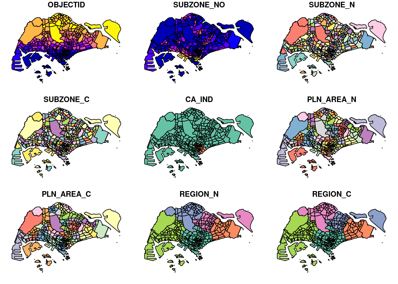
Plotting a single attribute
plot(mpsz["PLN_AREA_N"])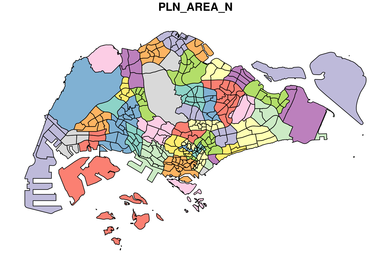
Working with Aspatial data
Aspatial data is data that is not geospatial in nature but contains fields that capture the x- and y-coordinates of the data points.
Importing the data
listings <- read_csv("data/aspatial/SG_Airbnb_Listing_Data/listings.csv")Rows: 3540 Columns: 75
── Column specification ────────────────────────────────────────────────────────
Delimiter: ","
chr (26): listing_url, source, name, description, neighborhood_overview, pi...
dbl (38): id, scrape_id, host_id, host_listings_count, host_total_listings_...
lgl (6): host_is_superhost, host_has_profile_pic, host_identity_verified, ...
date (5): last_scraped, host_since, calendar_last_scraped, first_review, la...
ℹ Use `spec()` to retrieve the full column specification for this data.
ℹ Specify the column types or set `show_col_types = FALSE` to quiet this message.Reading the data
list(listings)[[1]]
# A tibble: 3,540 × 75
id listing_url scrape_id last_scraped source name description
<dbl> <chr> <dbl> <date> <chr> <chr> <chr>
1 71609 https://www.airbnb.co… 2.02e13 2024-06-29 previ… Ensu… For 3 room…
2 71896 https://www.airbnb.co… 2.02e13 2024-06-29 city … B&B … <NA>
3 71903 https://www.airbnb.co… 2.02e13 2024-06-29 city … Room… Like your …
4 275343 https://www.airbnb.co… 2.02e13 2024-06-29 city … 10mi… **IMPORTAN…
5 275344 https://www.airbnb.co… 2.02e13 2024-06-29 city … 15 m… Lovely hom…
6 289234 https://www.airbnb.co… 2.02e13 2024-06-29 previ… Book… This whole…
7 294281 https://www.airbnb.co… 2.02e13 2024-06-29 city … 5 mi… I have 3 b…
8 324945 https://www.airbnb.co… 2.02e13 2024-06-29 city … Comf… **IMPORTAN…
9 330095 https://www.airbnb.co… 2.02e13 2024-06-29 city … Rela… **IMPORTAN…
10 344803 https://www.airbnb.co… 2.02e13 2024-06-29 city … Budg… Direct bus…
# ℹ 3,530 more rows
# ℹ 68 more variables: neighborhood_overview <chr>, picture_url <chr>,
# host_id <dbl>, host_url <chr>, host_name <chr>, host_since <date>,
# host_location <chr>, host_about <chr>, host_response_time <chr>,
# host_response_rate <chr>, host_acceptance_rate <chr>,
# host_is_superhost <lgl>, host_thumbnail_url <chr>, host_picture_url <chr>,
# host_neighbourhood <chr>, host_listings_count <dbl>, …Extracting the coordinates of each listing from the csv file and converting it into a data frame
listings_sf <- st_as_sf(listings, coords = c("longitude", "latitude"), crs=4326) %>% st_transform(crs=3414)Note that %>% is the pipe operator in R. EPSG: 4326 is wgs84 and EPSG: 3414 is Singapore SVY21 Projected Coordinate System. Refer to the EPSG website for details.
Listing each row of the csv file
glimpse(listings_sf)Rows: 3,540
Columns: 74
$ id <dbl> 71609, 71896, 71903, 2753…
$ listing_url <chr> "https://www.airbnb.com/r…
$ scrape_id <dbl> 2.024063e+13, 2.024063e+1…
$ last_scraped <date> 2024-06-29, 2024-06-29, …
$ source <chr> "previous scrape", "city …
$ name <chr> "Ensuite Room (Room 1 & 2…
$ description <chr> "For 3 rooms.Book room 1 …
$ neighborhood_overview <chr> NA, NA, "Quiet and view o…
$ picture_url <chr> "https://a0.muscache.com/…
$ host_id <dbl> 367042, 367042, 367042, 1…
$ host_url <chr> "https://www.airbnb.com/u…
$ host_name <chr> "Belinda", "Belinda", "Be…
$ host_since <date> 2011-01-29, 2011-01-29, …
$ host_location <chr> "Singapore", "Singapore",…
$ host_about <chr> "Hi My name is Belinda -H…
$ host_response_time <chr> "within an hour", "within…
$ host_response_rate <chr> "100%", "100%", "100%", "…
$ host_acceptance_rate <chr> "N/A", "N/A", "N/A", "99%…
$ host_is_superhost <lgl> FALSE, FALSE, FALSE, FALS…
$ host_thumbnail_url <chr> "https://a0.muscache.com/…
$ host_picture_url <chr> "https://a0.muscache.com/…
$ host_neighbourhood <chr> "Tampines", "Tampines", "…
$ host_listings_count <dbl> 6, 6, 6, 49, 49, 6, 7, 49…
$ host_total_listings_count <dbl> 11, 11, 11, 73, 73, 11, 8…
$ host_verifications <chr> "['email', 'phone']", "['…
$ host_has_profile_pic <lgl> TRUE, TRUE, TRUE, TRUE, T…
$ host_identity_verified <lgl> TRUE, TRUE, TRUE, TRUE, T…
$ neighbourhood <chr> NA, NA, "Singapore, Singa…
$ neighbourhood_cleansed <chr> "Tampines", "Tampines", "…
$ neighbourhood_group_cleansed <chr> "East Region", "East Regi…
$ property_type <chr> "Private room in villa", …
$ room_type <chr> "Private room", "Private …
$ accommodates <dbl> 3, 1, 2, 1, 1, 4, 2, 1, 1…
$ bathrooms <dbl> NA, 0.5, 0.5, 2.0, 2.5, N…
$ bathrooms_text <chr> "1 private bath", "Shared…
$ bedrooms <dbl> 2, 1, 1, 1, 1, 3, 2, 1, 1…
$ beds <dbl> NA, 1, 2, 1, 1, NA, 1, 1,…
$ amenities <chr> "[\"Free parking on premi…
$ price <chr> NA, "$80.00", "$80.00", "…
$ minimum_nights <dbl> 92, 92, 92, 180, 180, 92,…
$ maximum_nights <dbl> 365, 365, 365, 999, 999, …
$ minimum_minimum_nights <dbl> 92, 92, 92, 180, 180, 92,…
$ maximum_minimum_nights <dbl> 92, 92, 92, 180, 180, 92,…
$ minimum_maximum_nights <dbl> 1125, 1125, 1125, 1125, 1…
$ maximum_maximum_nights <dbl> 1125, 1125, 1125, 1125, 1…
$ minimum_nights_avg_ntm <dbl> 92, 92, 92, 180, 180, 92,…
$ maximum_nights_avg_ntm <dbl> 1125, 1125, 1125, 1125, 1…
$ calendar_updated <lgl> NA, NA, NA, NA, NA, NA, N…
$ has_availability <lgl> TRUE, TRUE, TRUE, TRUE, T…
$ availability_30 <dbl> 30, 30, 30, 28, 0, 29, 30…
$ availability_60 <dbl> 59, 53, 60, 58, 0, 58, 60…
$ availability_90 <dbl> 89, 83, 90, 62, 0, 88, 90…
$ availability_365 <dbl> 89, 148, 90, 62, 0, 88, 3…
$ calendar_last_scraped <date> 2024-06-29, 2024-06-29, …
$ number_of_reviews <dbl> 19, 24, 46, 20, 16, 12, 1…
$ number_of_reviews_ltm <dbl> 0, 0, 0, 0, 2, 0, 0, 1, 1…
$ number_of_reviews_l30d <dbl> 0, 0, 0, 0, 0, 0, 0, 0, 0…
$ first_review <date> 2011-12-19, 2011-07-30, …
$ last_review <date> 2020-01-17, 2019-10-13, …
$ review_scores_rating <dbl> 4.44, 4.16, 4.41, 4.40, 4…
$ review_scores_accuracy <dbl> 4.37, 4.22, 4.39, 4.16, 4…
$ review_scores_cleanliness <dbl> 4.00, 4.09, 4.52, 4.26, 4…
$ review_scores_checkin <dbl> 4.63, 4.43, 4.63, 4.47, 4…
$ review_scores_communication <dbl> 4.78, 4.43, 4.64, 4.42, 4…
$ review_scores_location <dbl> 4.26, 4.17, 4.50, 4.53, 4…
$ review_scores_value <dbl> 4.32, 4.04, 4.36, 4.63, 4…
$ license <chr> NA, NA, NA, "S0399", "S03…
$ instant_bookable <lgl> FALSE, FALSE, FALSE, TRUE…
$ calculated_host_listings_count <dbl> 6, 6, 6, 49, 49, 6, 7, 49…
$ calculated_host_listings_count_entire_homes <dbl> 0, 0, 0, 0, 0, 0, 1, 0, 0…
$ calculated_host_listings_count_private_rooms <dbl> 6, 6, 6, 49, 49, 6, 6, 49…
$ calculated_host_listings_count_shared_rooms <dbl> 0, 0, 0, 0, 0, 0, 0, 0, 0…
$ reviews_per_month <dbl> 0.12, 0.15, 0.29, 0.15, 0…
$ geometry <POINT [m]> POINT (41972.5 3639…Geoprocessing
Buffering
Getting the total area of land required for widening the existing cycling path by 5 metres:
buffer_cycling <- st_buffer(cyclingpath, dist=5, nQuadSegs=30)
buffer_cycling$AREA <- st_area(buffer_cycling)
sum(buffer_cycling$AREA)
2218855 [m^2]Point-in-polygon count
Getting the number of pre-schools in each planning sub-zone. st_intersects merge both the sub-zone and the pre-school data, while lengths does the counting.
mpsz3414$`PreSch Count` <- lengths(st_intersects(mpsz3414, preschool3414))
summary(mpsz3414$`PreSch Count`)
Min. 1st Qu. Median Mean 3rd Qu. Max.
0.00 0.00 4.00 7.09 10.00 72.00 glimpse(mpsz3414)Rows: 323
Columns: 17
$ OBJECTID <int> 1, 2, 3, 4, 5, 6, 7, 8, 9, 10, 11, 12, 13, 14, 15, 16, …
$ SUBZONE_NO <int> 1, 1, 3, 8, 3, 7, 9, 2, 13, 7, 12, 6, 1, 5, 1, 1, 3, 2,…
$ SUBZONE_N <chr> "MARINA SOUTH", "PEARL'S HILL", "BOAT QUAY", "HENDERSON…
$ SUBZONE_C <chr> "MSSZ01", "OTSZ01", "SRSZ03", "BMSZ08", "BMSZ03", "BMSZ…
$ CA_IND <chr> "Y", "Y", "Y", "N", "N", "N", "N", "Y", "N", "N", "N", …
$ PLN_AREA_N <chr> "MARINA SOUTH", "OUTRAM", "SINGAPORE RIVER", "BUKIT MER…
$ PLN_AREA_C <chr> "MS", "OT", "SR", "BM", "BM", "BM", "BM", "SR", "QT", "…
$ REGION_N <chr> "CENTRAL REGION", "CENTRAL REGION", "CENTRAL REGION", "…
$ REGION_C <chr> "CR", "CR", "CR", "CR", "CR", "CR", "CR", "CR", "CR", "…
$ INC_CRC <chr> "5ED7EB253F99252E", "8C7149B9EB32EEFC", "C35FEFF02B13E0…
$ FMEL_UPD_D <date> 2014-12-05, 2014-12-05, 2014-12-05, 2014-12-05, 2014-1…
$ X_ADDR <dbl> 31595.84, 28679.06, 29654.96, 26782.83, 26201.96, 25358…
$ Y_ADDR <dbl> 29220.19, 29782.05, 29974.66, 29933.77, 30005.70, 29991…
$ SHAPE_Leng <dbl> 5267.381, 3506.107, 1740.926, 3313.625, 2825.594, 4428.…
$ SHAPE_Area <dbl> 1630379.27, 559816.25, 160807.50, 595428.89, 387429.44,…
$ geometry <MULTIPOLYGON [m]> MULTIPOLYGON (((31495.56 30..., MULTIPOLYG…
$ `PreSch Count` <int> 0, 6, 0, 5, 3, 13, 5, 1, 11, 1, 4, 2, 0, 1, 6, 0, 0, 0,…Getting the districts with the most number of pre-schools.
top_n(mpsz3414, 1, `PreSch Count`)Simple feature collection with 1 feature and 16 fields
Geometry type: MULTIPOLYGON
Dimension: XY
Bounding box: xmin: 39655.33 ymin: 35966 xmax: 42940.57 ymax: 38622.37
Projected CRS: SVY21 / Singapore TM
OBJECTID SUBZONE_NO SUBZONE_N SUBZONE_C CA_IND PLN_AREA_N PLN_AREA_C
1 189 2 TAMPINES EAST TMSZ02 N TAMPINES TM
REGION_N REGION_C INC_CRC FMEL_UPD_D X_ADDR Y_ADDR SHAPE_Leng
1 EAST REGION ER 21658EAAF84F4D8D 2014-12-05 41122.55 37392.39 10180.62
SHAPE_Area geometry PreSch Count
1 4339824 MULTIPOLYGON (((42196.76 38... 72Calculate the density of pre-schools of each district.
mpsz3414$Area <- mpsz3414 %>% st_area()
mpsz3414 <- mpsz3414 %>% mutate(`PreSch Density` = `PreSch Count` / Area * 1000000)
glimpse(mpsz3414)
Rows: 323
Columns: 19
$ OBJECTID <int> 1, 2, 3, 4, 5, 6, 7, 8, 9, 10, 11, 12, 13, 14, 15, 16…
$ SUBZONE_NO <int> 1, 1, 3, 8, 3, 7, 9, 2, 13, 7, 12, 6, 1, 5, 1, 1, 3, …
$ SUBZONE_N <chr> "MARINA SOUTH", "PEARL'S HILL", "BOAT QUAY", "HENDERS…
$ SUBZONE_C <chr> "MSSZ01", "OTSZ01", "SRSZ03", "BMSZ08", "BMSZ03", "BM…
$ CA_IND <chr> "Y", "Y", "Y", "N", "N", "N", "N", "Y", "N", "N", "N"…
$ PLN_AREA_N <chr> "MARINA SOUTH", "OUTRAM", "SINGAPORE RIVER", "BUKIT M…
$ PLN_AREA_C <chr> "MS", "OT", "SR", "BM", "BM", "BM", "BM", "SR", "QT",…
$ REGION_N <chr> "CENTRAL REGION", "CENTRAL REGION", "CENTRAL REGION",…
$ REGION_C <chr> "CR", "CR", "CR", "CR", "CR", "CR", "CR", "CR", "CR",…
$ INC_CRC <chr> "5ED7EB253F99252E", "8C7149B9EB32EEFC", "C35FEFF02B13…
$ FMEL_UPD_D <date> 2014-12-05, 2014-12-05, 2014-12-05, 2014-12-05, 2014…
$ X_ADDR <dbl> 31595.84, 28679.06, 29654.96, 26782.83, 26201.96, 253…
$ Y_ADDR <dbl> 29220.19, 29782.05, 29974.66, 29933.77, 30005.70, 299…
$ SHAPE_Leng <dbl> 5267.381, 3506.107, 1740.926, 3313.625, 2825.594, 442…
$ SHAPE_Area <dbl> 1630379.27, 559816.25, 160807.50, 595428.89, 387429.4…
$ geometry <MULTIPOLYGON [m]> MULTIPOLYGON (((31495.56 30..., MULTIPOL…
$ `PreSch Count` <int> 0, 6, 0, 5, 3, 13, 5, 1, 11, 1, 4, 2, 0, 1, 6, 0, 0, …
$ Area [m^2] 1630379.27 [m^2], 559816.25 [m^2], 160807.50 [m^2], 5…
$ `PreSch Density` [1/m^2] 0.0000000 [1/m^2], 10.7178026 [1/m^2], 0.0000000 [1…Plotting with ggplot2
hist(mpsz3414$`PreSch Density`)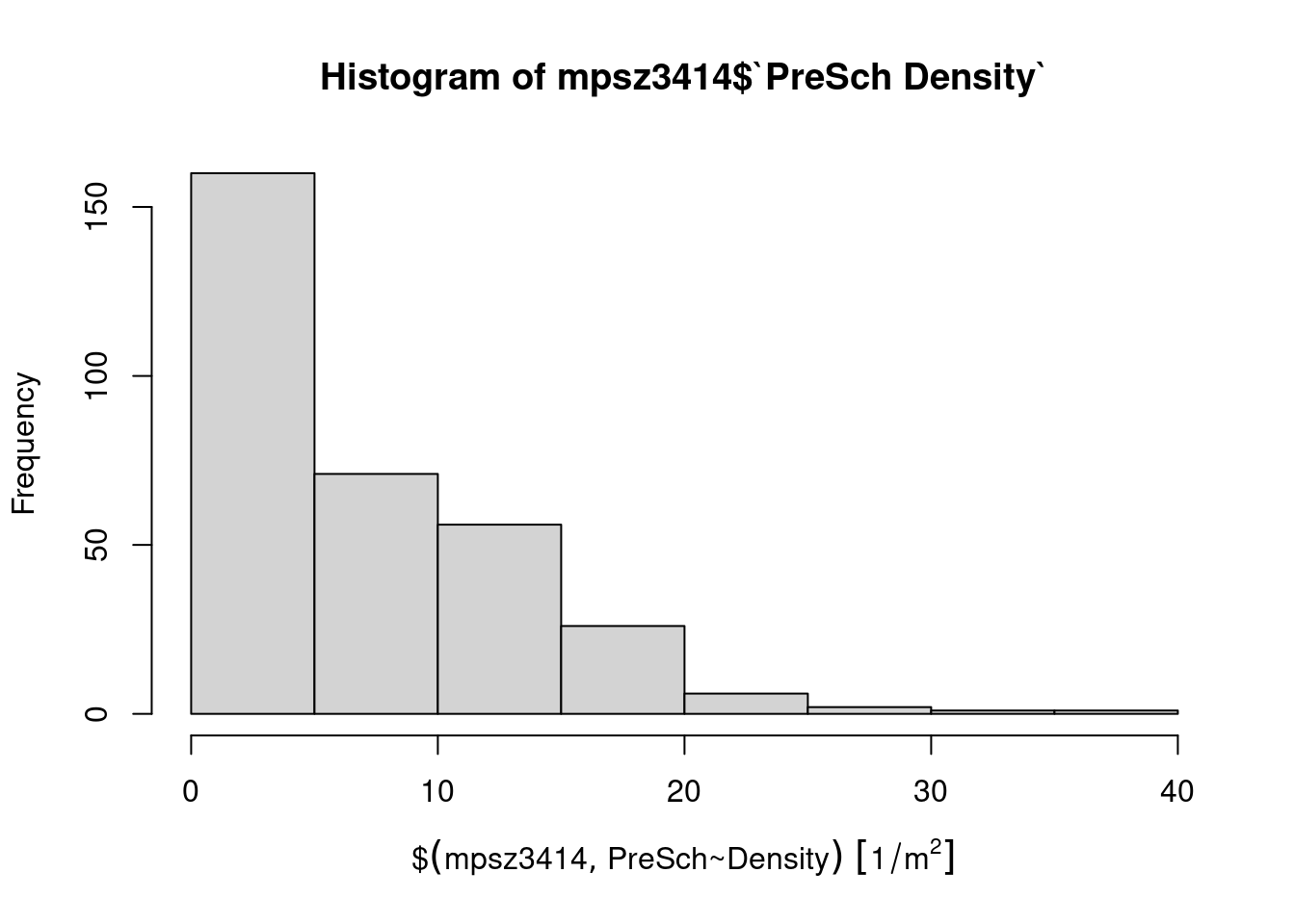
ggplot(data=mpsz3414,
       aes(x= as.numeric(`PreSch Density`)))+
  geom_histogram(bins=20,
                 color="black",
                 fill="light blue") +
  labs(title = "Are pre-school even distributed in Singapore?",
       subtitle= "There are many planning sub-zones with a single pre-school, on the other hand, \nthere are two planning sub-zones with at least 20 pre-schools",
      x = "Pre-school density (per km sq)",
      y = "Frequency")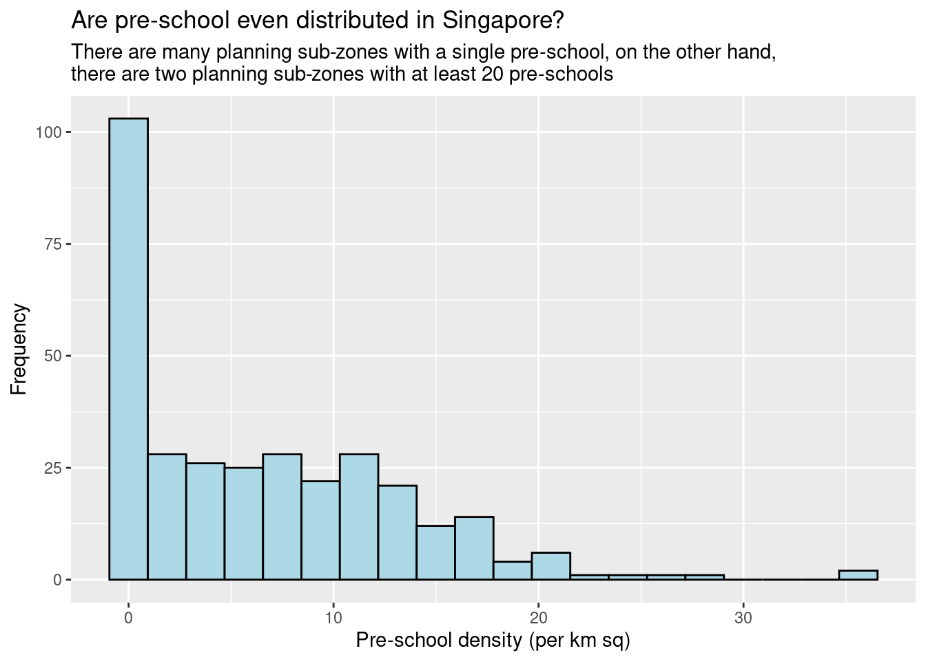
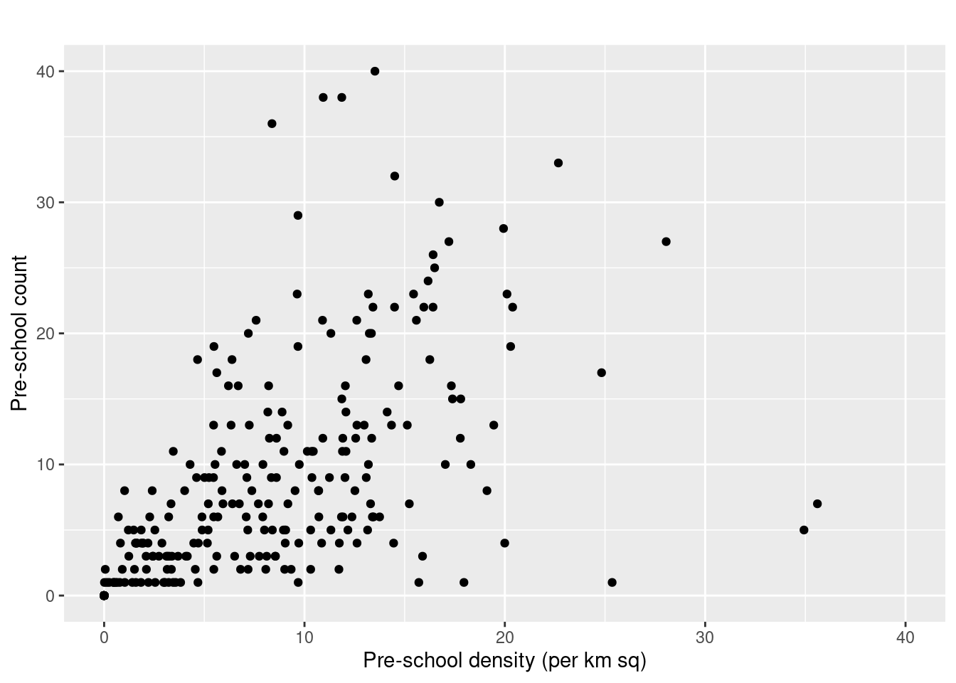
ggplot(data=mpsz3414,
       aes(y = `PreSch Count`,
           x= as.numeric(`PreSch Density`)))+
  geom_point(color="black",
             fill="light blue") +
  xlim(0, 40) +
  ylim(0, 40) +
  labs(title = "",
      x = "Pre-school density (per km sq)",
      y = "Pre-school count")
Warning: Removed 2 rows containing missing values or values outside the scale range
(`geom_point()`).